

Construction Surveyor for Phased Residential Developments
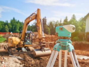 Phase one of a subdivision usually goes in clean. The site is open, the plans are fresh, and every crew works from the same marks. Trouble tends to show up in phase two or three, when a new road has to meet an old one and a sewer line has to tie into pipe that’s been buried for a year.
If the survey data doesn’t carry over cleanly, small errors start to stack up. A curb line drifts a few tenths of a foot. A manhole rim sits too high. Lots that looked perfect on paper end up short at the back corners.
A construction surveyor who stays with the project from start to finish keeps those phases tied together. The same control, records, and standards follow the work from the first stake to the final as-built. That continuity is one of the best protections a developer can have.
How a Construction Surveyor Supports Each Phase of Residential Development
A construction surveyor turns approved plans into marks crews can build from. On a phased project, that work repeats with each new section, but it never starts from scratch. Each phase builds on the data and control set during the last one.
The tasks repeat in a steady cycle. Most phases need some version of each item below. Timing depends on your schedule and the contractor’s sequence.
- Setting and checking survey control
- Staking roads, curbs, and lot corners
- Staking storm, sewer, and water lines
- Checking grades on pads, swales, and streets
- Preparing as-built surveys for completed work
Keeping one surveyor on the full project reduces handoff mistakes. A new firm brought in at phase three has to learn the site, verify old control, and sort through someone else’s files. That takes time, and it raises the chance of a mismatch.
Establishing Survey Control Across Multiple Construction Phases
Survey control is the network of fixed points every measurement on the site ties back to. Good control is set early, placed where construction won’t destroy it, and tied to the same coordinate system and elevation datum used in the engineering plans. If phase one and phase three start from different points, the pieces won’t line up.
Control points take a beating on active sites. Graders, trenching, and stockpiles can bury or shift them without anyone noticing. Your construction surveyor should check control at the start of each phase and before any critical staking.
Ask how control will be protected and documented. A clear control sheet with point numbers, coordinates, and elevations helps every future crew. Keep a copy in your own project records, not only in the surveyor’s files.
Coordinating Lot Layouts, Road Alignments, and Utility Installations
Roads, lots, and utilities share the same tight space, so their layout has to work as a set. Street centerlines set the curb lines, and curb lines set the lot fronts. Utilities run under or beside the pavement, and each one needs room to clear the others.
Gravity lines need the most care. Sanitary sewer and storm pipe depend on slope to flow, so their flow lines must closely match the plan. A small error at a tie-in point can force a costly fix where a new phase connects to old pipe.
Before staking a new phase, the surveyor should locate the stubs left from earlier work. Those are the pipe and conduit ends built to extend into the next section. Confirming their real position and elevation early lets the engineer adjust the design before crews start digging.
Verifying Grading and Elevations Before Moving to the Next Phase
Grading problems are much easier to fix before the next phase begins. Once new streets and homes go up nearby, changing drainage on finished lots gets harder and more expensive. A grade check at the end of each phase catches issues while equipment is still on site.
A construction surveyor can shoot spot elevations on pads, swales, curbs, and inlets and compare them to the grading plan. Some jurisdictions or builders also ask for pad certifications or form surveys before slabs are poured. Requirements vary by municipality and builder, so confirm them early in the schedule.
Pay close attention to where phases meet. Runoff from a new phase may flow toward lots that are already finished. Checking those edge areas helps prevent standing water and unhappy homeowners after sales close.
Using As-Built Surveys to Document Completed Development Stages
An as-built survey records what was actually built in the field. Many cities and utility providers ask for as-built data before they accept streets and public utilities. The exact requirements depend on the municipality and project scope.
Treat each as-built as the starting point for the next phase. It tells the design team where things really landed. A good package for a completed phase often shows:
- Final pipe locations, sizes, and flow line elevations
- Manhole and inlet rim elevations
- Curb, pavement, and sidewalk locations
- Fire hydrants, valves, and service stubs
- Final grades on key drainage features
Keep these records organized by phase. They help with city acceptance, warranty questions, and future repairs. They also give the next phase a reliable base to start from.
Frequently Asked Questions
Why is a construction surveyor important for phased residential developments?
Phased projects depend on each section fitting the one before it. A construction surveyor keeps roads, utilities, and lots tied to the same control and plans. That reduces mismatches where phases connect. It also gives developers clear records for city review and future work.
How does survey control remain consistent across different construction phases?
Control stays consistent when every phase uses the same coordinate system, datum, and control network. The surveyor checks existing points before each phase and replaces any that were disturbed. New points are tied back to the original network. A documented control sheet keeps everyone working from the same numbers.
When should construction staking begin for each development phase?
Staking usually begins once plans are approved and the contractor is ready to start that work. Many crews need stakes a few days before they mobilize. Ask your contractor for a staking schedule and share it with the surveyor early. Last-minute staking requests can delay crews and raise costs.
Can construction surveys help coordinate roads and underground utilities?
Yes, that’s one of their main jobs. The surveyor stakes road alignments and utility lines from the same plans and control. Locating existing stubs and checking elevations helps avoid conflicts between pipes, curbs, and other utilities. Good coordination cuts down on field changes and rework.
What survey records are needed before starting the next construction phase?
Most teams want an as-built survey of the completed phase, current control data, and recent grade checks. Records of utility stubs and their elevations are especially useful. Some cities need as-built data before accepting public improvements. Confirm what your municipality and engineer require before scheduling the next phase.